

TOKYO - Japan's first major cold spell of the season brought snow, freezing winds and record-low autumn temperatures across the country, with 639 observation points registering their coldest readings of the season on October 29, while forecasts issued that evening indicated that temperatures would recover on October 30 as rain spread across much of the country.
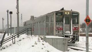
The cold spell began intensifying on October 28 as some of the strongest cold air of the season swept across northern Japan, bringing the first snowfall to Sapporo, Hakodate and Aomori, along with several other locations in Hokkaido and the Tohoku region.
Seven observation locations reported their first snow of the season, while mountain peaks across northern and central Japan received their first snow cover. These included Mount Iwaki in Aomori, Mount Zao on the border of Miyagi and Yamagata prefectures, and Mount Hakusan, which straddles Ishikawa and Gifu prefectures.
In Aomori City, October snowfall was recorded for the first time in 16 years, while the Sukayu hot spring area, known for some of the heaviest snowfall in Japan, experienced a sudden accumulation that reached 22 centimeters at one point.
Temperatures at Sukayu dropped to minus 3.8 degrees Celsius on October 28, while Makkari in Hokkaido recorded minus 2.6 degrees as a winter pressure pattern developed across the Japanese archipelago.
Snow-covered roads caused hazardous driving conditions in mountainous areas, with several accidents reported near Sukayu. In one incident, a passenger car skidded on a snowy mountain road and collided with an oncoming bus.
Strong winds accompanied the cold outbreak, prompting the Japan Meteorological Agency to announce the season's first winter wind, known as kogarashi ichigo, in both Tokyo and the Kinki region on October 28, six days earlier than last year.
In central Tokyo, a northwesterly gust reached 16.9 meters per second at around 5:20 a.m., while Hikone in Shiga Prefecture recorded a north-northwesterly gust of 15.2 meters per second. The cold winds made temperatures feel considerably lower, sending commuters reaching for coats, scarves and other winter clothing.
The chill intensified overnight into October 29, when temperatures dropped below freezing at 130 observation points nationwide, the highest number of locations to experience a freezing day so far this season.
A total of 639 locations recorded their lowest temperatures of the season as cold air lingering at higher altitudes combined with clear skies that allowed heat to escape from the ground overnight.
Central Tokyo recorded a minimum temperature of 10.4 degrees Celsius, its lowest of the season, while temperatures in many inland areas of the Kanto region fell into single digits.
Residents across the capital responded by adding extra layers of clothing. One woman in her 20s said she had chosen a leather outfit covering her neck and thick socks to protect against the cold, while another resident in her 60s said she was wearing three layers.
The sharp temperature drop also produced unusual natural scenery across Japan.
In Kesennuma, Miyagi Prefecture, where the minimum temperature fell to 1.7 degrees Celsius, sea smoke appeared over the coastal waters. The phenomenon occurs when cold air moves across relatively warm seawater, causing moisture to rise and condense into mist that drifts above the surface.
Farther south, in Takachiho, Miyazaki Prefecture, a spectacular sea of clouds filled the valleys as the morning sun illuminated the mist, producing a landscape that drew admiration from visitors.
A tourist from Kyoto described the view as incredibly beautiful, while another said the mystical scenery seemed to promise good fortune.
Despite the wintry temperatures, autumn foliage continued to advance across much of the country, creating striking contrasts between snow-covered mountains in the north and colorful trees farther south.
In Saitama Prefecture, a roughly three-kilometer avenue of ginkgo trees had turned bright yellow and reached its seasonal peak, attracting families enjoying the changing leaves.
Among the visitors was a family introducing their baby to autumn foliage for the first time. A three-year-old boy nearby enthusiastically collected acorns, while his mother said the outing provided a welcome opportunity to experience the season.
Around the Imperial Palace in central Tokyo, trees have also begun turning red as autumn colors gradually spread through the capital.
The weather is expected to change significantly on October 30, with a trough of low pressure and associated frontal systems bringing widespread cloud cover and rain from Kyushu to Hokkaido.
According to forecasts issued on the evening of October 29, western Japan will experience rain mainly during the morning, with some areas seeing heavy downpours accompanied by thunder.
Rain will begin clearing from the west during the afternoon, with improving conditions expected across Kyushu, Chugoku and Shikoku. The Kinki region, however, is likely to remain wet for much of the day.
The Tokai and Hokuriku regions are also expected to experience rain, while unstable atmospheric conditions could produce thunderstorms and locally heavier rainfall along the Sea of Japan coast.
In the Kanto region, cloudy skies will dominate on October 30, although the deterioration in weather is expected to be relatively limited. Rain may fall along the Pacific coast early in the morning, particularly around the Boso Peninsula, while northern Kanto could see showers during the afternoon.
Central Tokyo is expected to remain mostly cloudy, with some sunny intervals and a chance of brief rain.
Temperatures will rise noticeably compared with October 29 as warmer air moves across the country. Tokyo is forecast to reach 22 degrees Celsius, with a minimum of around 14 degrees, offering relief after the season's coldest morning.
Elsewhere, the forecast highs for October 30 include 18 degrees in Sapporo and Aomori, 19 degrees in Sendai, Niigata, Nagoya and Osaka, 23 degrees in Hiroshima and Okayama, and 22 degrees in Fukuoka.
Kagoshima is expected to reach 26 degrees, while Naha in Okinawa could climb to 29 degrees, highlighting the substantial temperature differences between northern and southern Japan.
Northern Japan will also experience a temporary easing of the cold, with many areas of Hokkaido and Tohoku expected to record daytime temperatures above 15 degrees despite cloudy skies and intermittent rain.
However, the warmer conditions are unlikely to last.
Forecasters expect another winter pressure pattern to develop on October 31 as a frontal system moves away from Japan, allowing colder air to return from the north.
Rain is expected to continue in parts of northern Japan and along the Sea of Japan coast over the weekend, with some areas of Hokkaido potentially experiencing further snowfall.
The unsettled pattern is forecast to continue into early November as successive low-pressure systems and cold air masses move across the archipelago, bringing repeated fluctuations in temperature along with periods of rain, strong winds and snow in northern areas.
Another widespread spell of rain is possible around November 2.
The rapid changes in weather mark the transition toward winter, with forecasters warning that the contrast between relatively mild daytime temperatures and sharply colder mornings could become more pronounced as November approaches.
Source: TBS